Before we get into it
A little heads up before your eyes continue their, hopefully pleasant, journey on this page: The following lines describe a self guided track. This means we organised, carried and did everything by ourselves. When we were doing this track in August 2019 we were 2 of a few hikers and, as far as we were able to judge, the only ones doing it without a supporting tour.
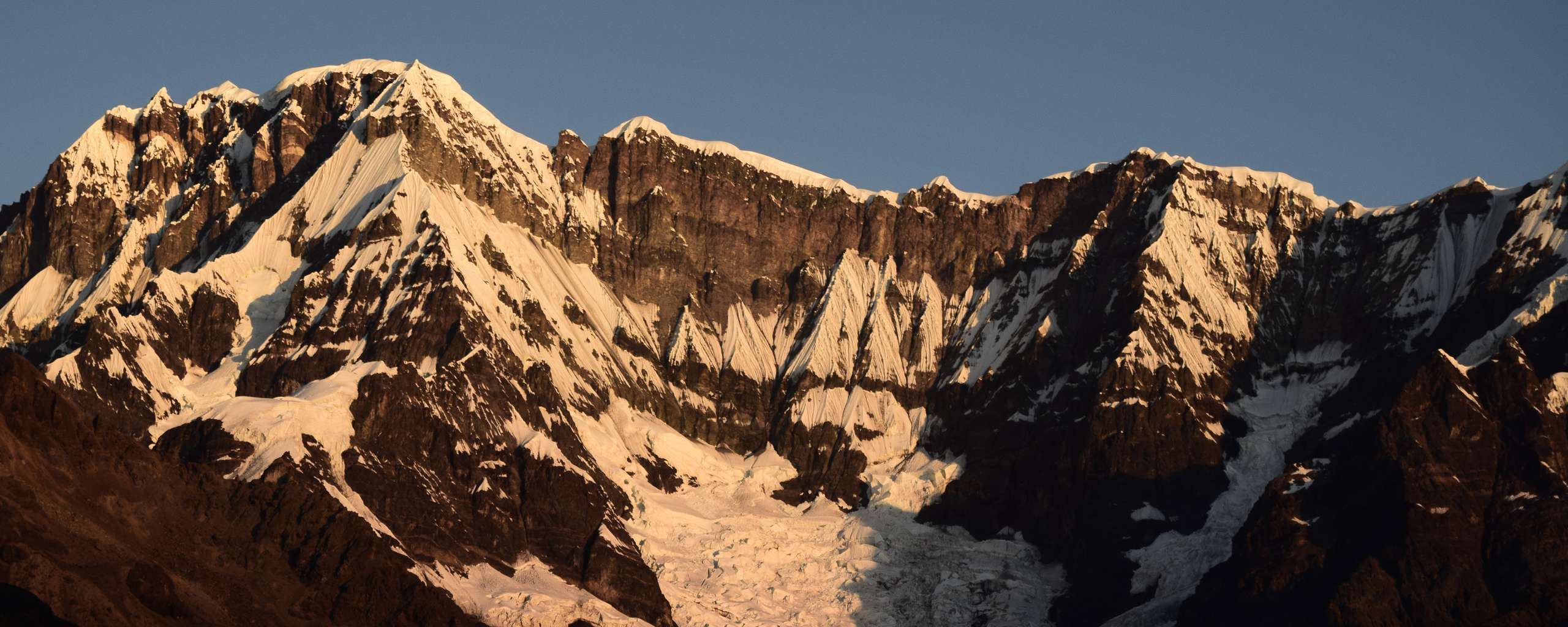
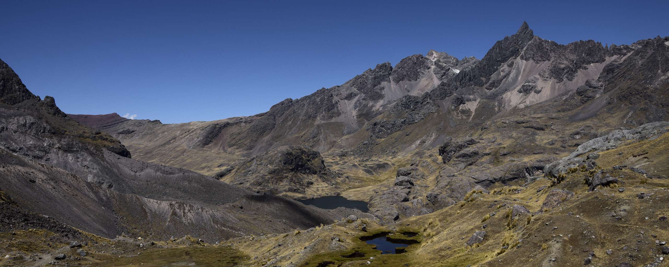
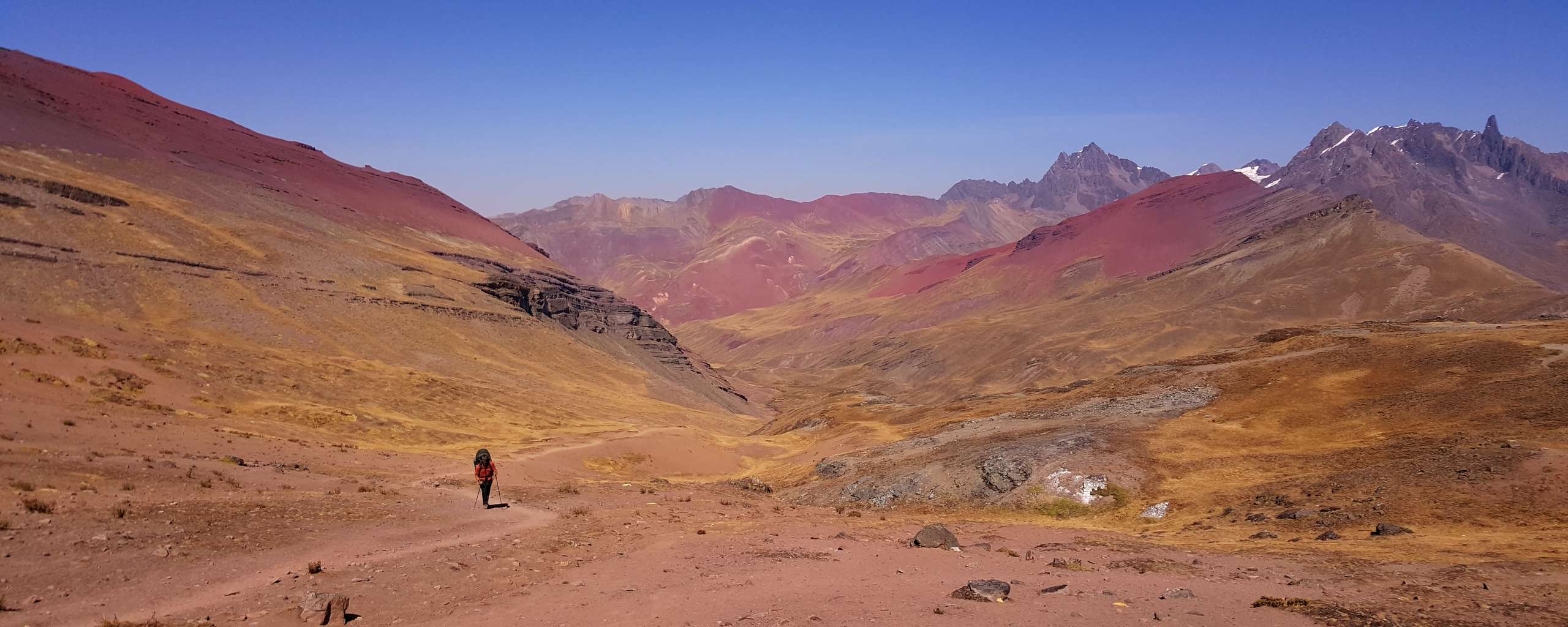
Personally I found the track sections themselves fairly easy. Even crossing the highest point on the fourth day went smoother than first expected being able to look at it from the campground the night before. Here comes the big B U T:
Darryn and I were comfortably acclimatised, both having lived at higher altitudes for the months prior and just having done a 6000er climb. That being said some of the people we met doing the track at the same time as us were struggling with a bit of altitude sickness. They had to do sections on the horse travelling as part of the tour crew for cases like that. I'd say that altitude is the major difficulty factor for this track as there are no technical sections if you keep with the circuit track. Read more here about trekking at high altitude and why it shouldn't be underestimated.
Basics
For us this track wasn't an actual full circuit. While we left the car in Tinki and theoretically started from and finished there we did use a taxi to get to Upis and used another one to get from Pacchanta back to Tinki. This was primarily due to arriving late on the same day as beginning the hike (track start) and wanting to avoid walking road sections (track finish).
That being said it is entirely possible to do the track as a full loop.
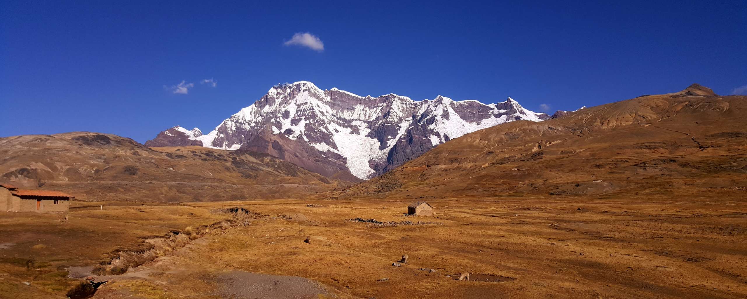
There are two hot springs at beginning and finish of the track. One a few minutes away from Upis and one in Pacchanta.
As of August 2019 we did not have to book anything in advance. Most of the campsites we chose to stay at were very basic, anything from a sheltered hole in the ground as toilets to even a tiny shop. Each night we paid 10 SOL per person, except for the first night when we stayed at Upis and only paid 5 SOL per person. The whole payment "process" was a bit funny. As I understand none of the payments are mandatory, so technically you don't have to pay anything. But the track crosses land inhabited by Quechua communes. So, the payments go to these communes. For multiple reasons I recommend to pay as it also sort of serves as a security. Obviously refusing to pay local communities while crossing land they inhabit doesn't send the best message and in return may not be so welcomed.
Some places felt so remote and empty of humans (and animals except for llamas) that I was fascinated at first to suddenly have a Quechua woman or man ask me for a fee. And as quick as they have appeared they disappeared into the mountains again.
Apparently, you also have to pay a fee to hike the circuit which you usually pay when passing a wee house between Tinki and Upis. The driver of the taxi we took from Tinki to Upis had a giggle racing past this kiosk unnoticed. Smiling he told us something along the lines "I just saved you guys a few Soles, hehe".
A little note: Back in 2019 we were told by locals that there are plans to "update and boost" this track, building actual huts and campgrounds, fancier tourist toilets, etc. With that I assume there'll be actual and higher fees hikers will have to pay. Unfortunately, I could not find any current information about what happened to these plans, especially given what else has been happening since then.
Getting prepped and ready
We stocked up all our supplies and needs for the coming days of trekking in Puno, located at Lago Titicaca. For us this was the last major city on our route before Tinki so getting everything there felt like an obvious choice. Tinki only has a few small shops so it does make sense to get necessary supplies for a multi day hike in Cusco.
Getting there
We were coming from the Southeast of Peru as we just crossed the border from Bolivia to Peru a few days prior. Travelling by car offers a bit more flexibility with regards to how and when to get there compared to being dependent on public transport. There are buses going from Cusco to Tinki on a regular basis as far as I know. Unfortunately, I cannot provide you a handy link to a website with more information on bus travel. Though I recommend asking the people at the place you are staying at if you need more insights into a way to the start of this track, especially if you're in a city like Cusco which is very touristy and tourist friendly. Usually hostels, campgrounds and even private accommodations are familiar with travellers and can provide helpful details. If you do not find help there you can always head to the tourist information, la Información al Turista, or in Peru there's also a tourist service called iPeru. They have a page dedicated to the Nevado Ausangate here.
Beside the beautiful experience of having lots of flexibility, travelling across bits of South America by car regularly confronted me with the sometimes more, sometimes less challenging question:
Where do I leave Murphy (my car) while disappearing into some mountain ranges for days, sometimes weeks?
In the case of the Ausangate Track this question was of the almost not challenging at all kind. Using a mobile app called iOverlander we found a marked spot in Tinki where someone was offering secure parking on their property, even hidden behind a gate. Even if you're not by car but are travelling across South America at any point in the future I can recommend this app. You'll find a collection of reviews and comments about just anything from laundry over insights on certain border crossings (some of them can be quite a pain in the ass while others barely take a minute, so any information on what to be aware of can be helpful) to a place for the night, hidden gems, etc.
Dropping the car off and getting to our personal start of the track was miraculously easy. Before arriving in Tinki we spent the night in Yanaoca, a 4-5 hours drive away. When we arrived in Tinki, we knocked on Don's gate, parked the car in his backyard between some kids toys that I tried not to break while driving in. Easy.
It was 5 Sol per day of parking so for us it ended up being a total of 25 Sol for 5 days. Since we arrived reasonably late that day we decided to take a taxi to Upis which more than halved our hiking distance to only 5km that day. Don called a friend while we were packing up our backpacks and a wee while later we were bargaining the price for the ride. We spend 50 Sol. Keep in mind that taxi prices can be very "individual". It may heavily depend on your Spanish knowledge, the driver, the circumstances, the actual route, your budget, and and and.
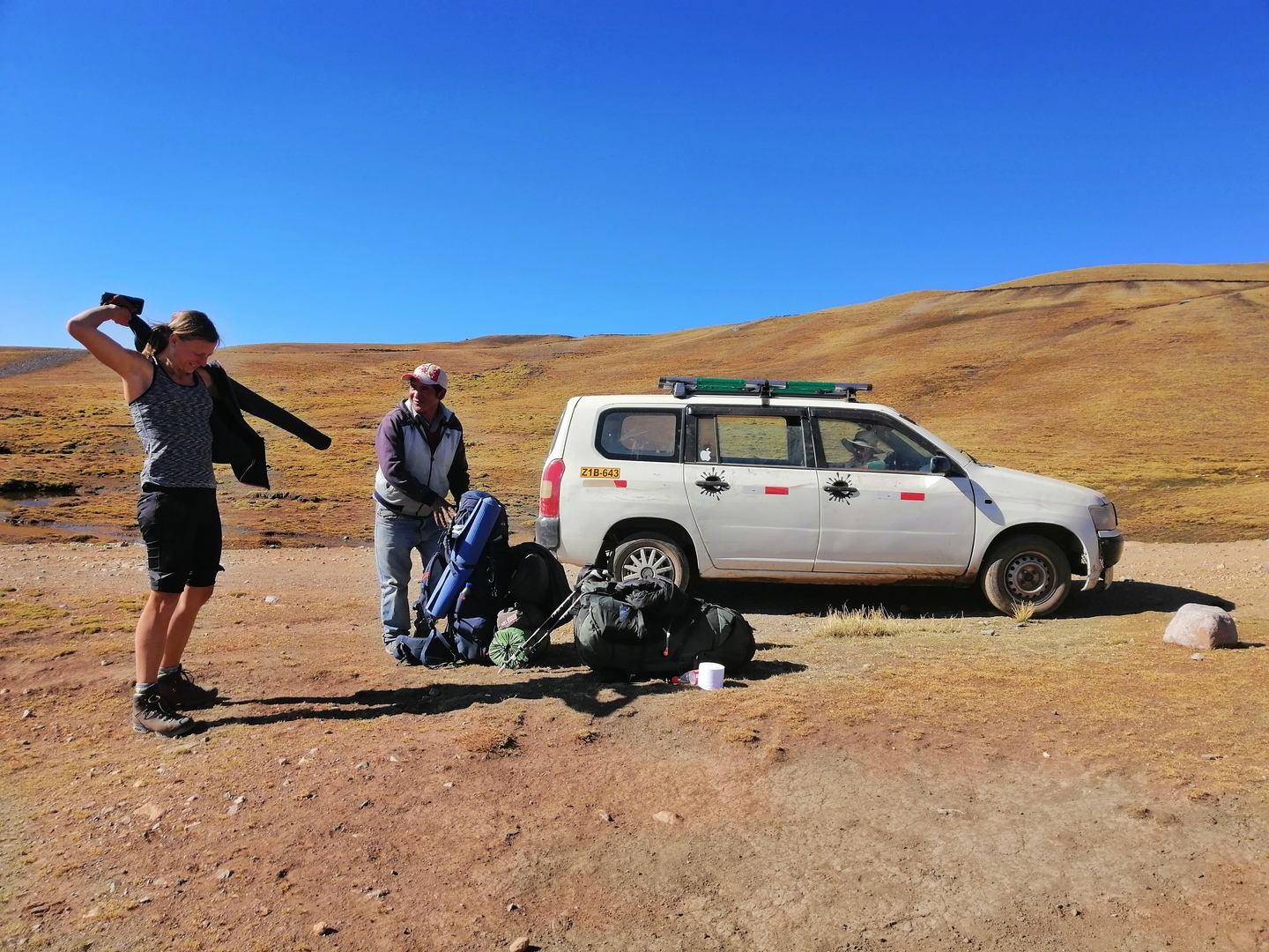 Our taxi driver after trying to pick up my backpack :D He was quite shocked...
The taxi driver made a detour for us over the local market to get some snacks and off we were. Supposedly it's just 6km from Tinki to where we were dropped off but it took us longer than 30 mins for the drive given the road situation.
Step by Step
I’ve summarised facts, difficulty rating and my personal experiences of each single day on the following sub pages:

Leave a comment*
(*Please see A word or two.)